If you’ve ever tried navigating a construction site using old paper maps and a vague sense of direction, you know how fast things can go sideways. Real estate development isn’t the same game it was even five years ago. Land is more expensive, regulations are tighter, and one wrong turn in planning can cost millions.
That’s why platforms that surface the latest insights and tech trends, are paying attention to smart mapping. Developers and investors aren’t just chasing data. They are chasing clarity, speed, and confidence. Those things are in short supply without the right tools.
Smarter Fieldwork, Smarter Decisions
In real estate, early decisions make or break projects. That’s where smart mapping and field data collection tools come in. You’re not just collecting information anymore. You are collecting leverage.
Using tools to improve fieldwork productivity helps capture real-time data on site conditions, zoning boundaries, and environmental hazards, while reducing the back-and-forth with paper records or secondhand information. It’s not about being fancy. It’s about not having to redo a site plan because someone misread the terrain.
When you cut down on guesswork at the front end, you don’t just save money, but you also save your team from headaches that last months.
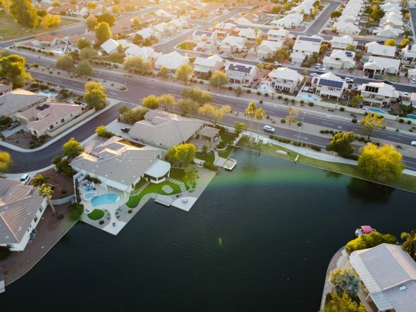
Mapping the Market—Literally
Understanding a piece of land is one thing. Understanding the humans who live around it is next level.
With smart mapping, developers can overlay demographics, income trends, and future transportation plans right onto the landscape. This data is tagged with a GPS location.
Identifying where families are relocating, where schools are expanding, or where climate risks are increasing can make or break a pitch to investors. It appears that a bit of digital mapping can significantly help prevent those dreaded "why didn’t we anticipate this?" discussions that everyone dislikes in the boardroom.
Collaboration Without the Chaos
Recall the lengthy email exchanges, disorganized PDFs, and slow approvals? No one misses that. Everyone can work together in real-time on the same map using sophisticated mapping tools, including engineers and local authorities. Miscommunication drastically decreases, updates are instantaneous, and changes are visible. Instead of presenting multiple plays on the same stage, it seems as though everyone is finally reading the same script.
This is crucial when budgets and timetables are limited. When there is less conflict and more openness, collaboration is more effective.
Sustainability Gets a Boost
Green building isn’t just a trend. It’s a demand. Cities demand it, buyers expect it, and lenders reward it. Smart mapping enables developers to understand environmental regulations, identify protected zones, and plan for flood risks before construction. This approach is both ethical and beneficial for business.
When your project clears permitting more quickly and avoids PR disasters, everyone benefits. More and more, developers are leaning on mapping tech not just to build, but to build responsibly. Because reputation matters, and so does the planet you're building on.
The Risk Factor Shrinks
Smart mapping won’t guarantee your project goes perfectly, but it sure lowers the odds of expensive surprises. You’ll see the fault lines, fire zones, and compliance risks before signing off. Investors notice that level of foresight. It tells them you’ve done your homework. It also tells regulators you’re not here to play fast and loose with permits. In a landscape of uncertainty, a well-charted site offers tranquility.
Conclusion: More Than Just Technology—It's Assurance
Smart mapping is about understanding the land, risks, rules, and community before building. This isn’t just efficient—it’s wise. In real estate, wisdom often prevails.