The world of surveying is a complex and high-tech industry that revolves around the blending of technology and human intelligence. In days gone by, it used to involve more of the latter than the former, but as technology has progressed, more and more surveyors are finding that by combining their expertise with the plethora of technological tools at their disposal, they can generate far more accurate surveys and in turn, generate more revenue per job as well as outmaneuver their competition that may still be reluctant to utilize the latest and greatest in technology. Throughout this article, we are going to look at how specific solutions can dramatically elevate your business by increasing efficiency, accuracy, and attention to detail.
Data Collection Software Allows For Greater Processing Power
When one thinks about land surveying perhaps the most common image to pop into the mind is that of a man with a laser device affixed upon a tripod of some kind. While this is undoubtedly accurate in terms of some of the tools used in this sector, all tools are moot without the processing power to collect and analyze the data they provide. If you visit The Carlson Guy website, for instance, you will see not only the surveying tools themselves on display but also a plethora of data handling devices and software that allows the surveyor to interpret all the information that is flowing in from their various tools. In reality, this is what helps the business to make money as it turns raw information into something usable for clients to consider when planning a purchase or build of some description.
Drones Make It Easier To Get A Lay Of The Land
Drones have become utterly ubiquitous in recent years and are pretty much part and parcel of every aspect of human existence, from farming to warfare. However, outside of the mundane and terrifying uses, they also serve a vital use in surveying large tracts of land from a bird's eye point of view, as well as areas that may be slightly more challenging for a human to enter with more standard surveying gear. Moreover, they are often relatively straightforward to operate and have a slight learning curve.
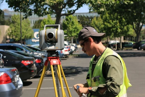
Photo by Scott Blake on Unsplash
5G Increases Bandwidth, Allowing More Tools To Speak" With Each Other
5G has been around for a decent amount of time by now, and if your only interaction with it is via your mobile handset, you might believe that it isn't anything particularly special outside of loading your YouTube videos faster. However, 5G really shines because of the enormous bandwidth that enables multiple things to communicate simultaneously. For our purposes in this article, this means that you can set up numerous devices that all collect data and are able to send the info back to a single device in real time. This can give you a considerable amount of flexibility that has otherwise been out of reach for most of the time.
Surveying involves the use of a range of different tools and technology, all intended to make the job easier and the data more accurate. By utilizing the latest in technology, you can massively increase your output and acquire more clients as you scale up.